🏠 Home 👥 About Us 🧭 Services 🖼️ Gallery 📦 Packages ❓ FAQs 📝 Blogs ✉️ Contact Us
Get a Quote Book Now
The Ultimate Guide to Hunza Valley: When to Go, What to See & Where to Stay
Destinations

The Ultimate Guide to Hunza Valley: When to Go, What to See & Where to Stay

June 2025
Karimabad, Hunza DistrictGilgit-Baltistan, Pakistan · 2,435 m
36.3158° N, 74.6597° E

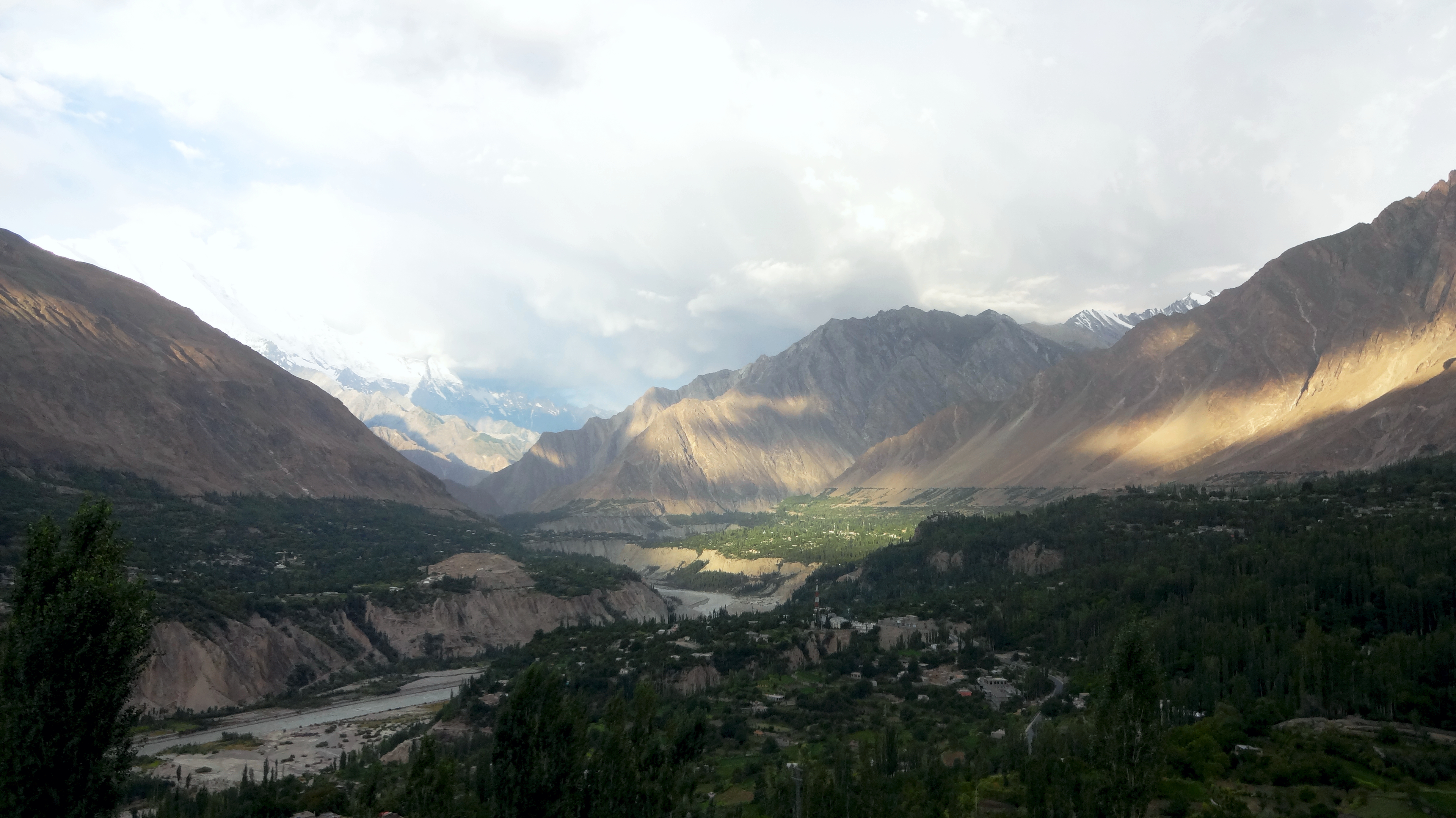
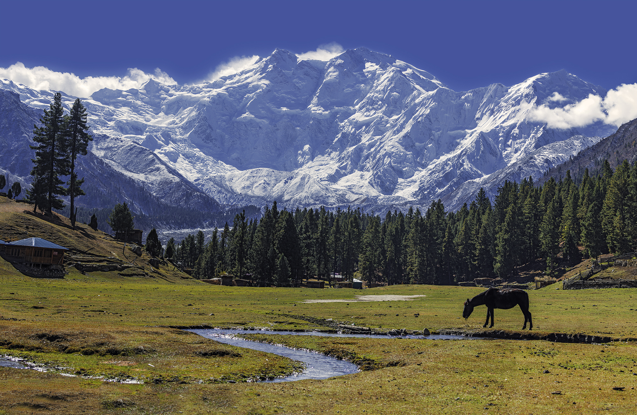
Cradled in the Karakoram and often called the real-life Shangri-La, Hunza is the valley that turns first-time visitors into repeat travellers. Apricot orchards, turquoise lakes, seven-thousand-metre peaks and a famously warm, literate community all sit within a short walk of its compact capital, Karimabad.

When to go

Hunza is at its best from April to October. Spring (late March to mid-April) blankets the valley in cherry and apricot blossom; summer (June to August) brings warm, reliable weather but the biggest crowds; and autumn (late September to October) sets the poplars ablaze in gold and red under crisp, clear skies. Winters are dramatic and quiet but cold, with possible road closures.

What to see

  • Baltit Fort — the 700-year-old former seat of the Mir of Hunza, restored by the Aga Khan Trust and crowning the Karimabad skyline.
  • Altit Fort & Royal Garden — even older, perched above the Hunza River, with a beautifully kept orchard-garden below.
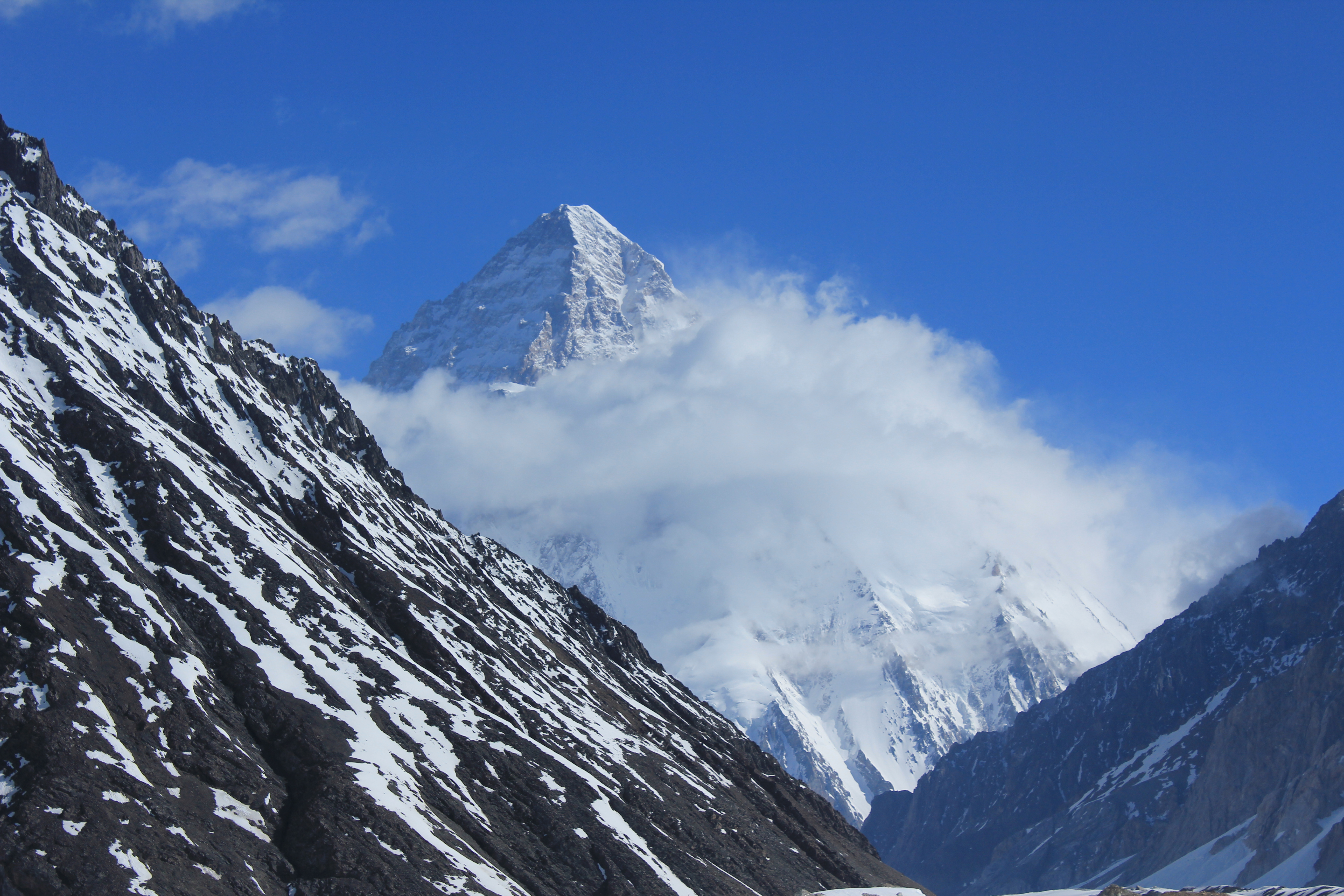
  • Eagle's Nest / Duikar viewpoint — the classic sunrise spot for panoramas of Rakaposhi, Ultar Sar, Diran and Golden Peak.
  • Attabad Lake — a vivid turquoise lake about an hour's drive up the Karakoram Highway, perfect for boating.
  • Karimabad Bazaar — cobbled lanes selling handicrafts, gemstones, dried fruit and Hunza's celebrated apricots.

Things to do

  • Hike up to Ultar Meadows beneath the Ultar Sar glacier for a half-day adventure from Karimabad.
  • Take a boat or jet-ski across Attabad Lake, then continue to the Passu Cones and the Hussaini hanging bridge.
  • Linger over coffee with a valley view at Café de Hunza, and shoot blossom or autumn colour at golden hour.
  • Arrange a jeep day-trip toward Khunjerab Pass — the highest paved international border crossing in the world.

Where to stay

Most travellers base in Karimabad for two to four nights. Eagle's Nest Hotel trades convenience for unbeatable views; Hunza Serena and a cluster of mid-range hotels sit near the bazaar; and budget guesthouses are plentiful in the old town. For a quieter upper-Hunza feel, Gulmit makes a lovely alternative base.

Best seasonApr–Oct
Altitude2,435 m
Stay2–4 nights
From Gilgit2–3 hr drive
K2 Base Camp Trek: Everything You Need to Know Before You Go
Adventure

K2 Base Camp Trek: Everything You Need to Know Before You Go

May 2025
K2 Base Camp, Baltoro GlacierCentral Karakoram National Park · ~5,150 m
35.8800° N, 76.5133° E

The trek to K2 Base Camp is one of the great walks of the planet — a 12-to-18-day expedition along the Baltoro Glacier that ends among a ring of giants no photo quite prepares you for. It demands real fitness and time, but rewards you with the closest legal view of the world's second-highest mountain.

The route, in brief

Almost every itinerary starts in Skardu, then takes a long jeep ride to Askole (3,050 m), the last village before the wilderness. From there the trail follows the 63-km Baltoro Glacier through a string of camps — Jhula, Paiju (a rest day), Khoburtse, Urdukas and Goro II — before opening onto Concordia (4,600 m), the legendary "Throne Room of the Mountain Gods." A day excursion takes you up the Godwin-Austen Glacier to K2 Base Camp and the moving Gilkey Memorial. Fit, well-acclimatised groups can return via the demanding Gondogoro La pass instead of retracing their steps.

What you'll see

  • K2 (8,611 m) — the "Savage Mountain," rising in a near-perfect pyramid above the glacier.
  • Concordia — a natural amphitheatre encircled by four 8,000 m peaks, including Broad Peak and Gasherbrum I & II.
  • Trango Towers & Cathedral Peak — some of the largest granite walls on Earth.
  • Masherbrum, Chogolisa and Muztagh Tower — a skyline of iconic Karakoram summits.

Difficulty & preparation

This is a challenging high-altitude trek: expect 6–8 hour days over moraine and glacier, reaching about 5,150 m. Strong cardiovascular fitness and careful acclimatisation are essential, and nights above Urdukas drop well below freezing — pack a sleeping bag rated to at least −15°C and a quality insulated mat. Travel insurance covering high-altitude helicopter evacuation is non-negotiable.

Permits & logistics

The trek runs through Central Karakoram National Park, so you'll need a CKNP permit (around USD 300), a Gilgit-Baltistan adventure fee (around USD 200) and a trekking permit. Going with a licensed operator is the practical norm — they arrange permits, a guide, porters, cooks and camping equipment as a full-board package.

Best seasonJun–Sep
Duration12–18 days
Max height~5,150 m
GradeChallenging
Fairy Meadows on a Budget: Hidden Costs, Best Cottages & Insider Tips
Culture

Fairy Meadows on a Budget: Hidden Costs, Best Cottages & Insider Tips

April 2025
Fairy Meadows, RaikotDiamer District, Gilgit-Baltistan · ~3,300 m
35.3869° N, 74.5783° E

A green alpine shelf staring straight at Nanga Parbat — the 8,126 m "Killer Mountain" — Fairy Meadows is the most accessible jaw-dropping campsite in Pakistan. It can also quietly drain your wallet if you don't plan ahead. Here's how to do it well without overspending.

Getting there

From the Karakoram Highway you turn off at Raikot Bridge, swap your vehicle for a local 4×4 jeep up the notorious Raikot track to Tato village (only experienced local drivers are permitted), then hike roughly 3–4 hours — or hire a pony — up to the meadows. It's an adventure in itself and part of the charm.

The hidden costs to budget for

  • Jeep fare from Raikot Bridge to Tato — much cheaper shared than chartered privately.
  • Vehicle parking at Raikot Bridge, charged per day.
  • Porter or pony if you'd rather not carry your pack up the trail.
  • Tent and sleeping-bag rental at the meadows, plus a premium on food and water at altitude.
  • Optional guide for the onward hike to Beyal Camp and the Nanga Parbat viewpoint.

Best cottages & camps

Raikot Sarai and the Fairy Meadows Cottages offer comfortable wooden lodges, while Greenland Resort is prized for arguably the clearest, most direct view of Nanga Parbat. For the lowest cost, rent a tent with a sleeping bag. If you have an extra day, camp at quieter Beyal Camp a few kilometres higher — fewer people, even bigger views.

Things to do

  • Hike on to Beyal Camp and the Nanga Parbat Base Camp viewpoint (around 3,900 m) for the full "Killer Mountain" panorama.
  • Stay up for the Milky Way — Fairy Meadows has some of the darkest, clearest night skies in the region.
  • Catch sunrise and sunset light shifting across the glacier and the great south face.

Budget insider tips

Go on weekdays and in the shoulder seasons (April–May or September–October) to dodge the summer crowds and inflated rates. Bring your own sleeping bag, carry snacks from Gilgit or Chilas, and share jeeps with other travellers at Raikot Bridge to split the most expensive single cost.

Best seasonApr–Oct
Altitude~3,300 m
Final hike3–4 hr
FacesNanga Parbat
5 Hidden Gems of Gilgit-Baltistan That Most Tourists Miss
Travel Tips

5 Hidden Gems of Gilgit-Baltistan That Most Tourists Miss

March 2025
Across Gilgit-BaltistanFive lesser-known valleys & lakes
36.1700° N, 74.1833° E

Hunza, Skardu and Fairy Meadows rightly headline most itineraries — but Gilgit-Baltistan hides whole valleys that the average visitor drives straight past. These five reward a little extra effort with solitude, colour and authentic mountain culture. Tap any coordinate to open it in Google Maps.

1. Naltar Valley

A short but rough jeep climb from Gilgit delivers you to pine forests, alpine pastures and the famous trio of jewel-toned Naltar lakes. It's also home to Pakistan's only ski resort, making it a rare year-round draw.

36.1700° N, 74.1833° E

2. Phander Valley, Ghizer

Out west on the road toward Shandur and Chitral, Phander is the valley locals call "mini Switzerland." Turquoise Phander and Khalti lakes, golden poplars and excellent trout fishing make it a serene, underrated overnight stop.

36.1633° N, 72.4783° E

3. Borith Lake, Upper Hunza

Above Passu, this high lake is a magnet for migratory birds and the perfect launch point for walks to the Passu Glacier and the swaying Hussaini hanging bridges, with the Passu Cones as a backdrop.

36.4419° N, 74.8722° E

4. Basho Valley, Skardu

A 4×4 detour from Skardu opens into lush meadows threaded with streams and pine forest — one of the region's best low-key camping spots, blissfully free of crowds.

35.4500° N, 75.3000° E

5. Shimshal Valley

The highest settlement in Hunza reachable by road, Shimshal is the home of legendary Pakistani mountaineers and a doorway to the Shimshal Pass and its summer Pamir pastures. The Wakhi hospitality here feels a world apart.

36.4333° N, 75.2167° E
Best seasonMay–Oct
Access4×4 / jeep
CrowdsLow
Gems5 valleys
Deosai National Park: Brown Bears, Wildflowers & the Roof of the World
Wildlife

Deosai National Park: Brown Bears, Wildflowers & the Roof of the World

February 2025
Deosai Plains (Sheosar Lake)Between Skardu & Astore · avg 4,114 m
34.9333° N, 75.4000° E

"Land of Giants," the locals call it — and at an average 4,114 m, Deosai is the second-highest plateau on Earth. For three short summer months its snow gives way to an endless rolling carpet of wildflowers, streams and the gentle, lumbering Himalayan brown bear.

When you can go

Deosai is only reachable from mid-June to early September; for the rest of the year it lies under deep snow. July and August are the sweet spot, when the meadows are in full bloom and wildlife is most active. Even then, nights are bitterly cold — pack as if for winter.

The wildlife

  • Himalayan brown bear — Deosai's flagship species and a genuine conservation success, recovering from around 19 individuals in 1993. They're most active April–October.
  • Golden marmots — whistling, sun-loving rodents you'll spot all across the plains.
  • Tibetan red fox, ibex and grey wolf — alongside the occasional, elusive snow leopard.
  • Birds of prey — golden eagles, bearded vultures and peregrine falcons riding the high winds.

What to do

  • Camp at Sheosar Lake (4,142 m) for mirror-still sunrise reflections — Bara Pani and Kala Pani are the other classic sites.
  • Photograph wildlife with a long lens; keep at least 300 m from bears and always explore with a guide.
  • Stargaze under near-zero light pollution — Deosai is one of Pakistan's finest spots for the Milky Way.
  • Trek to Sheosar Lake or out toward Deosai Top, and try licensed trout fishing in the streams.

Getting there & staying

Two routes climb onto the plateau: the rough but spectacular Skardu approach (4×4 strongly recommended) and the smoother Astore side. A national-park permit is required, and there are no hotels up top — you either camp in designated zones or base yourself in Skardu or Astore. Carry extra fuel, water and warm layers.

OpenJun–Sep
Avg height4,114 m
Star speciesBrown bear
Access4×4
A Deep Dive Into Hunzai Culture: Food, Festivals & Ancient Forts
Culture

A Deep Dive Into Hunzai Culture: Food, Festivals & Ancient Forts

January 2025
Baltit Fort, KarimabadHunza, Gilgit-Baltistan, Pakistan
36.3242° N, 74.6694° E

Beyond the postcard peaks, Hunza's deepest draw is its people — Burushaski- and Wakhi-speaking communities with a near-universal literacy rate, a proud Ismaili heritage, and a hospitality so generous it becomes the story travellers tell first.

The ancient forts

  • Baltit Fort — roughly 700 years old, with Tibetan-influenced architecture and a small museum. As the former residence of the Mir of Hunza, it anchors the entire Karimabad skyline.
  • Altit Fort — older still, reckoned the oldest monument in Gilgit-Baltistan, dramatically perched above the Hunza River with a restored Royal Garden below.

The food

Hunzai cooking is famously wholesome and organic. Look for chapshuro (a baked meat-filled pastry), diram fitti (a sweet wheat bread), harissa, mamtu (steamed dumplings) and apricot-based dishes from soup to oil. The valley's apricots, walnuts, mulberries and buckwheat appear in everything — and a cup of "Hunza water" (a salt-tea) rounds off most meals.

The festivals

  • Ginani — the midsummer harvest festival celebrating the first cutting of the wheat.
  • Navroz — the spring new year, full of music, food and family gatherings.
  • Spring blossom & Silk Route festivals — seasonal celebrations of fruit blossom and the valley's trading heritage, often with polo, rubab music and folk dance.

Things to do

  • Tour both forts, then wander the old lanes of Altit and Karimabad on a heritage walk.
  • Join a home-style cooking experience, or stop at the women-run Kha Basi café in Altit for traditional dishes.
  • Shop for gemstones, hand-knitted woollens and dried fruit in Karimabad Bazaar.

Visiting respectfully

Hunza is welcoming and relaxed, but it's still a traditional society — dress modestly, and always ask before photographing people, particularly women. A little courtesy is repaid many times over in cups of tea and conversation.

LanguagesBurushaski · Wakhi
Baltit Fort~700 yrs
SignatureApricots
FestivalGinani
🔒 End-to-end encrypted · No sign-up needed